|
|
Geography and Maps of Korovia
Korovia is a very mountainous kingdom with eight distinct mountain ranges:
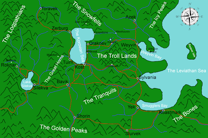
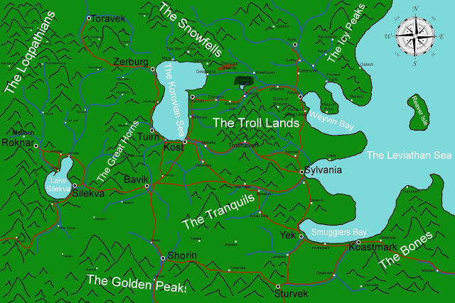
The region is not especially volcanic, but there are a few volcanoes within Korovia. The largest volcano is in the Bones, a massive mountain south-east of Koastmark. The crater at the top is said to be haunted by the ghost of a Loqland dragon, thus it is known as Ghostfyre Peak. Further north is the Ruins of Castle Waykesch, east of the elven village of Oraila. Castle Waykesch was destroyed in 4053 of the Fourth Age when the nearby Mount Waykesch erupted and destroyed the wealthy port town and castle. The Troll Mountains are said to be home to several dormant volcanoes. Despite being so mountainous, Korovia's valleys and forests are surprisingly fertile. Much of Korovia is either lush evergreen forests, and the further south you go deciduous trees become more popular. This fertility lends to agricultural production in "valley villages" such as Dangarn, Izhamet, Millkrest and others. The fertility is partially the quality of the soil and good climate. The valleys are also watered by mountain streams and rivers, which provide both a secondary source of water and also fish. Due to the harshness of the terrain, there are very few roads and highways which cut through the wilderness - many of which were ancient trading routes / routes used by ancient tribes during Korovia's Stone Age. The rivers and seaways also provide valuable trade routes. Korovia has many lakes and rivers. Only the major lakes and rivers are shown on the maps further below. Lake Silekva is the largest lake in Korovia, and is arguably an inland sea, except it is freshwater and contains no saltwater sea life. Korovia has two seas. the smaller inland Korovian Sea - which is salt water and contains a variety of saltwater sea life, including several varieties of sharks, octopi, giant squids and even whales. The Korovian Sea has an interesting feature: The north-east corner drains through an ancient dam built by gnomes at Deepstone and flows eastward through canals to a river that drains into the Leviathan Sea. The Leviathan Sea is similarly landlocked and contains a large variety of saltwater sea life, but is more famous for the variety of sea monsters that dwell within. Sea serpents, giant sea turtles, mammoth whales, sea dragons, dragon-turtles, and the aptly named Northern Leviathan (a half woman / half serpent creature said to be hundreds of feet tall that destroys ships with ease). All of Korovia, the Korovian Sea and the Leviathan Sea, and indeed much of the continent sits upon a giant plateau high above the ocean. If one travels south through Habbelund or Basikvia, they come to the Great Cliff - a massive cliff which crosses the continent from east to west and then north-west along the western shore of the continent. The northern reaches of the continent also has cliffs, but they are significantly smaller. The Great Cliff separate the northern kingdoms from the southern city-states of Al-Kazar. The Barren Wastes cover much of Al-Kazar, a great desert with few oases and havens from the scorching heat. Various pockets of Al-Kazar are more fertile, where towns and cities have sprung up. Further south the deserts give way to dense jungles. The Islands of Quinias lay off the coast of Al-Kazar and are largely jungle and a highly fertile region. There are said to be other continents of Aoerth, but very little is known about them. The Ancient Quinians are said to have visited all of the continents and brought back stories of strange lands, bizarre creatures, monsters, peoples, and types of magic unheard of.
MAPS OF KOROVIA
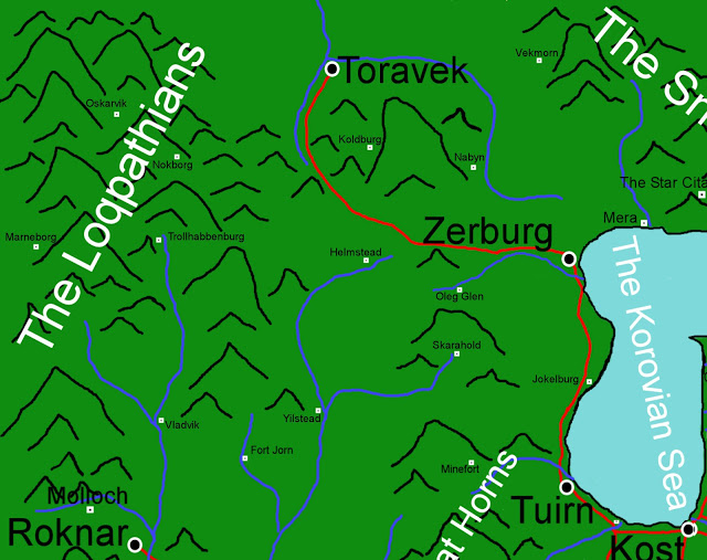
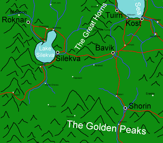
North West Detail of Korovia
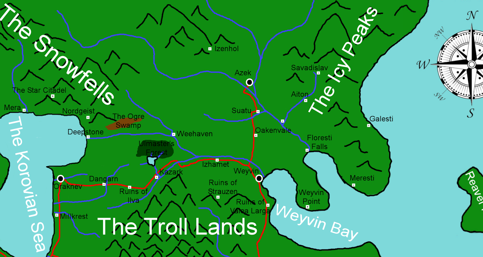
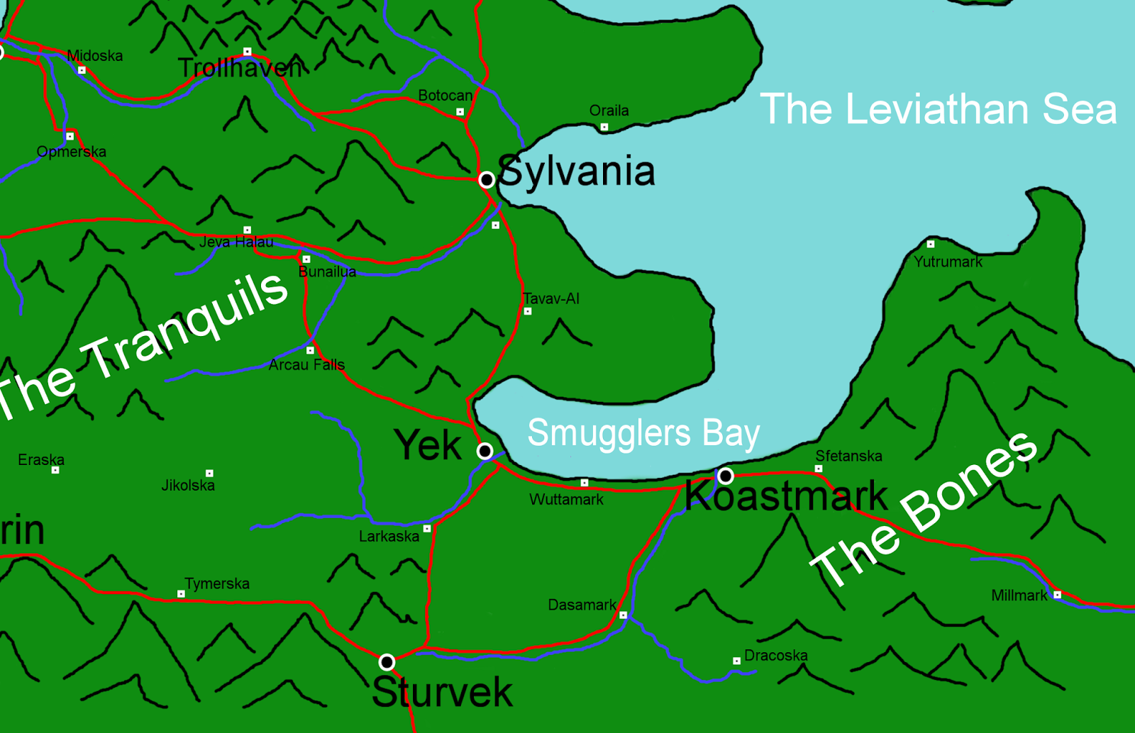
North East Detail of Korovia
South East Detail of Korovia
South West Detail of Korovia
MAPS OF OTHER REGIONS Below - Map of Al-Kazar
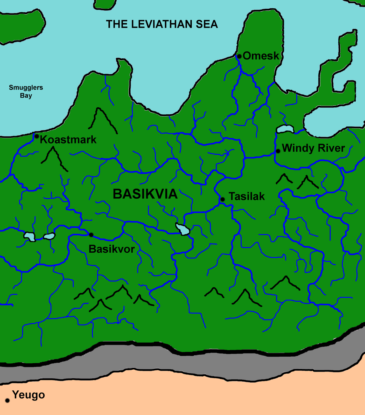
Below - Map of Basikvia
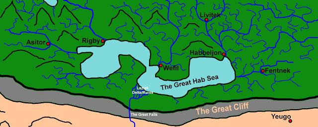
Below - Map of Habbeland
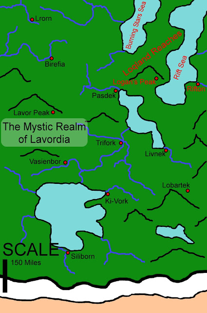
Below - Map of Lavordia
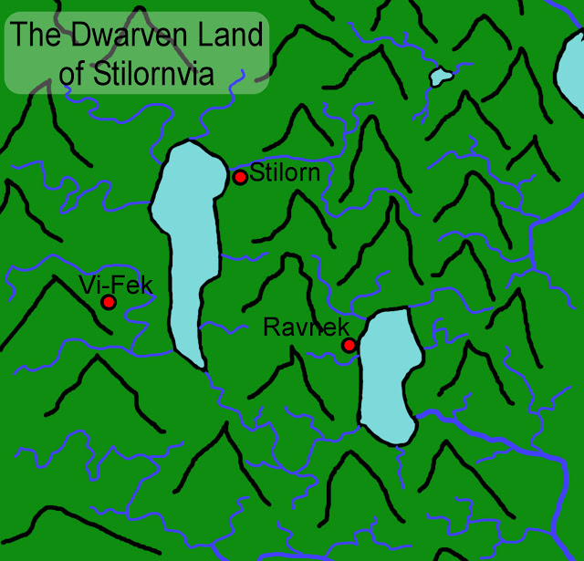
Below - Map of Stilornvia
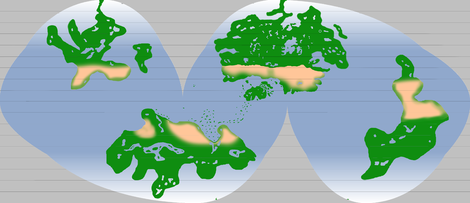
BELOW - GLOBAL MAP OF AOERTH
|

Website Design by designSEO.ca